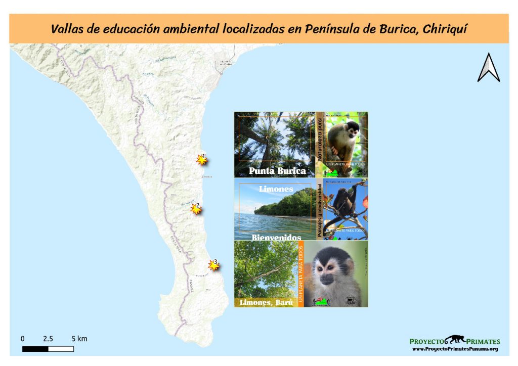
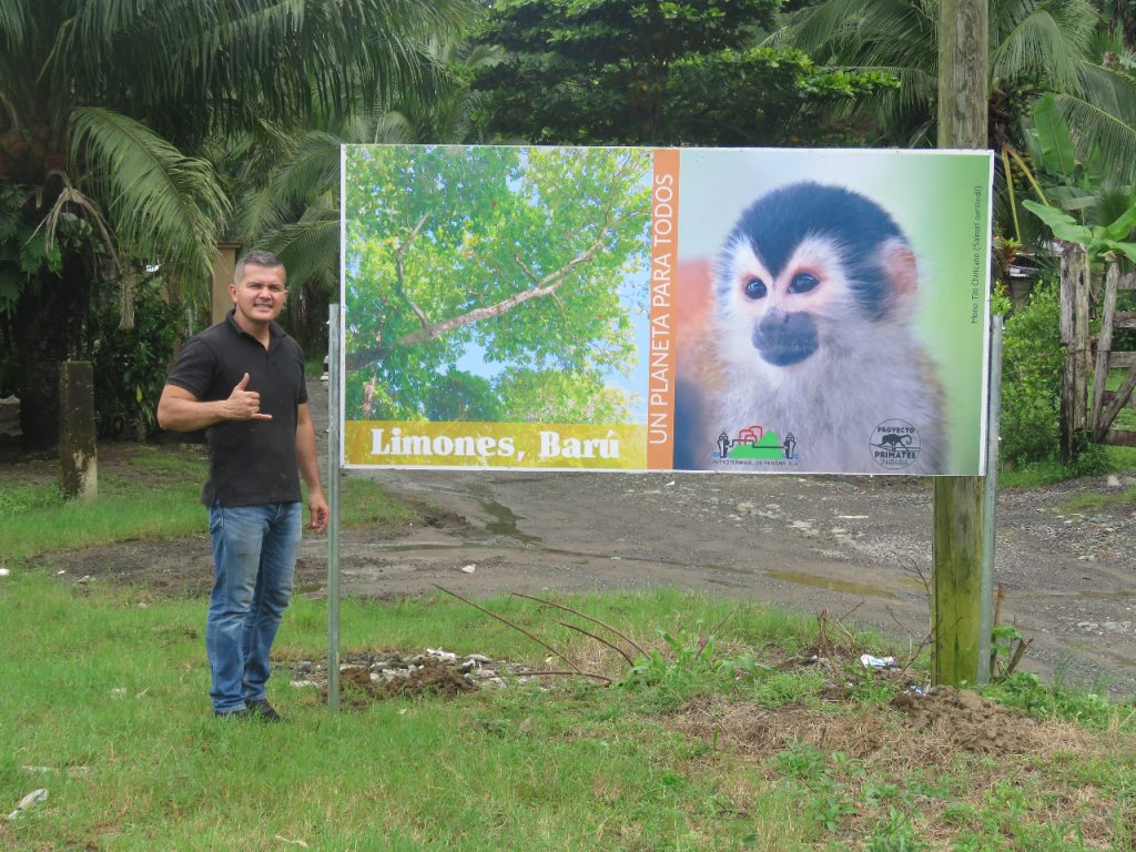
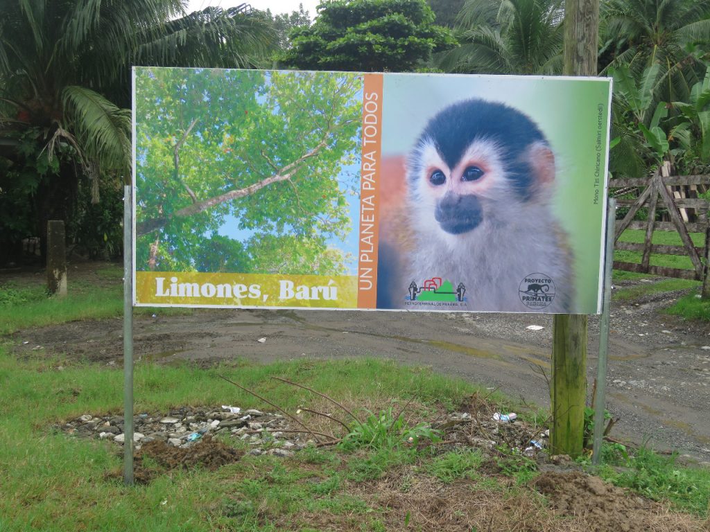
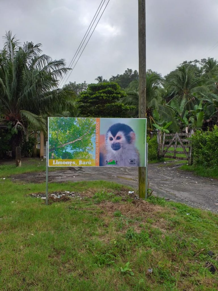
Localización geográfica de las vallas instaladas el 16 de noviembre de 2020.
Vallas instaladas en la Península de Burica
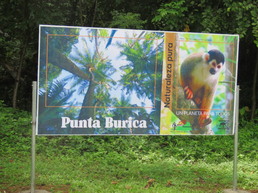
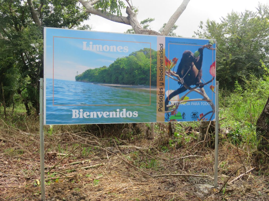
Colocación de vallas metálicas con imágenes y mensajes ambientales en distintos puntos de la Península de Burica fueron instalados, con la finalidad de resaltar las bellezas naturales que se encuentran en la zona y comunicar por qué es importante ejecutar acciones para conservar esa biodiversidad.
Hasta el momento se han colocado 3 vallas. De igual forma se está en el proceso de construcción de las estructuras para la colocación de nuevos pasos aéreos para fauna (Puentes mono) en varios sitios seleccionados que lo requieren.
Este proyecto cuenta con el apoyo de Petroterminal de Panamá, de líderes ecologistas comunitarios, como el señor Cirilo Lezcano e instituciones como el Colegio Primer Ciclo Punta Burica, la Junta Comunal de Limones y otros actores claves comunitarios.
Proyecto Primates Panamá reconoce la gran labor de los periodistas que forjan pensamiento crítico y que además difunden información ambiental clave para gestar en la conciencia colectiva una nueva cultura ambiental para el desarrollo sostenible.
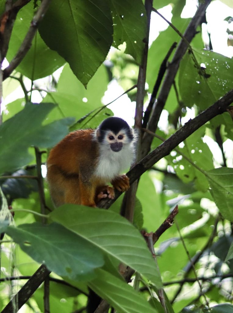
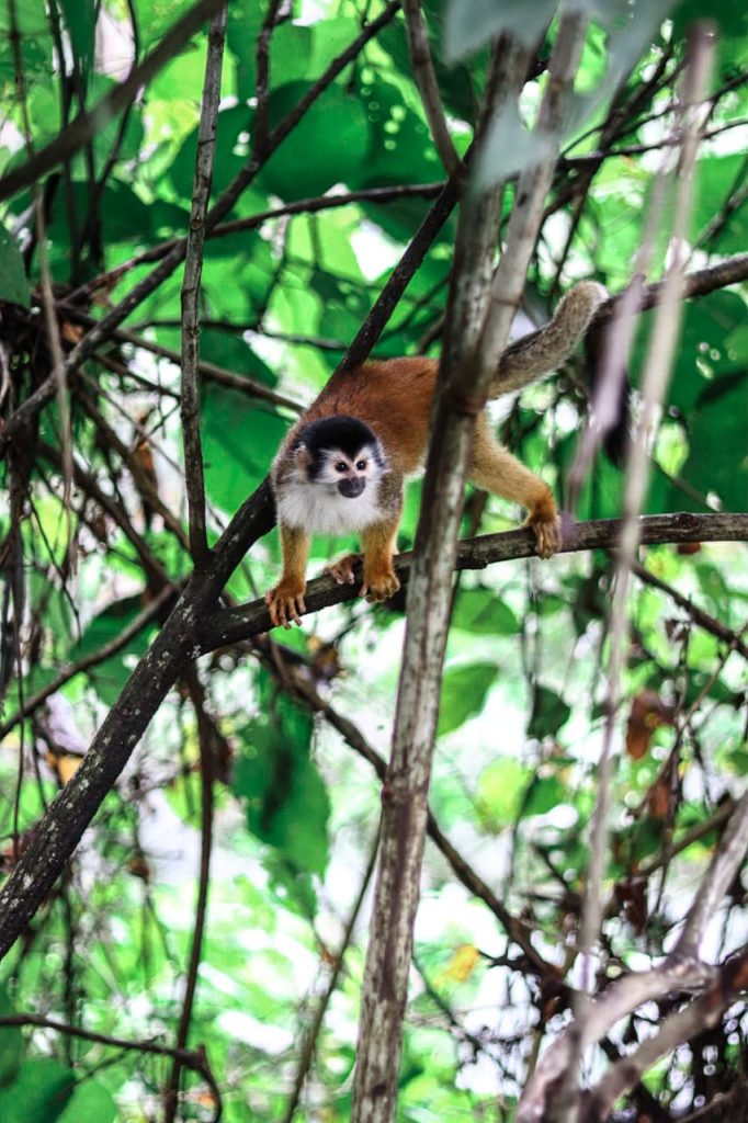
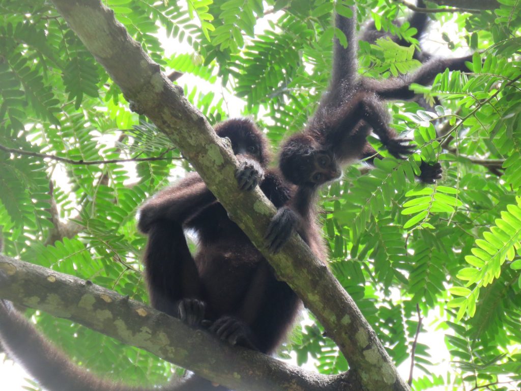
El mono tití es una especie que habita principalmente las tierras bajas y en osasiones remontan hasta tierras con altitudes intermedias.
Los monos fronterizos del distrito de Barú son un población muy dinámica en toda la Península de Burica, en Paso Canoas y en Fila de Cal.
Mono tití chiricano transfronterizo. Foto: José Luis Rodríguez
Hembra de Saimiri oestedii oerstedii
Mono tití chiricano, Saimiri oerstedii oestedii, hembra adulta de nombre María Teresa. Fotos: Jose Luis Rodríguez
En algunas partes de la distribución del mono tití chiricano hay tropas que se pueden considerar transfronterizas, ya que pueden rebasar la frontera y tener un área de distribución que incluye ambos países.
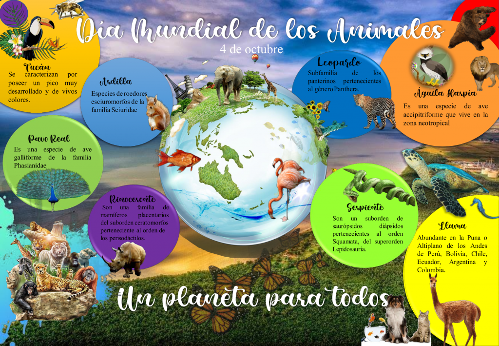
El Día Mundial de los Animales se celebra el 4 de octubre. Fue instaurado ese día para conmemorar a San Francisco de Asís, considerado el protector de los animales.Este día buscaenseñar a la humanidad cómo comprender nuestro lugar en la Tierra, ya que el bienestar de los humanos está directamente relacionado al bienestar de todo los animales y el ambiente.
En el año 1929 se declaró Día Mundial de los Animales, por iniciativa de la Organización Mundial de Protección Animal duranteun congreso celebrado en Viena. El objetivo principal fue generar una solución al problema de las especies en peligro de extinción.
La protección de los animales está directamente relacionado con la conservación de los hábitat.
En la actualidad el principal propósito del Día Mundial de los Animales es recordar la importancia de la conservación de las especies animales en todo el planeta.
Proyecto Primates Panamá se une a esta conmemoración anual con el despliegue de un afiche alusivo, que ha sido seleccionado en concurso. Este año ha sido galardonado el arte confeccionado por la estudiante universitaria, Patricia Paola Pimentel Mendoza, cuyo arte destaca muchos aspectos claves de los animales como la diversidad y muestra a la Tierra y sus hábitat con presencia humana como parte de un todo, similar al concepto “un planeta para todos”.
El día es conmemorativo, no festivo, lo que indica que su mensaje es para la reflexión y la acción en pro de la naturaleza y la diversidad animal.
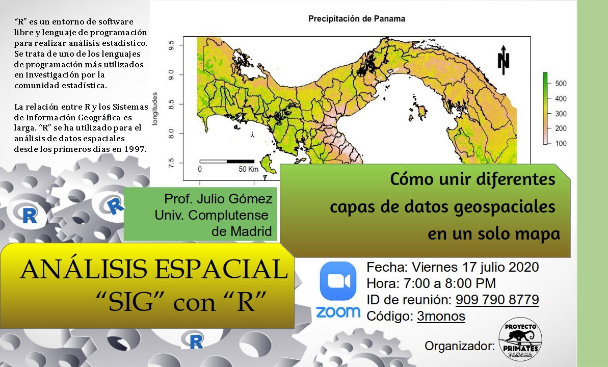
El viernes 17 de julio de 2020 se realizó el taller de Análisis Espacial Usando Lenguaje «R». Proyecto Primates Panamá promovió esta actividad como parte de sus jornadas de capacitación sobre ambientes informáticos libres que sirven para hacer ciencia de la conservación con herramientas informáticas innovadoras y que pueden ser utilizadas por todas las personas en sus temas diversos de acción.
La jornada de introducción al tema estuvo a cargo del Dr. Julio Gómez, geógrafo que ha incursionado en el lenguaje R para análisis espacial. Su conferencia fue una inducción sobre la forma de iniciarse en este lenguaje informático, lo cual incluyó la presentación de las fuentes de datos, la presentación del entorno gráfico del programa RStudio y el uso de scripts como modelos del uso de bases de datos pesadas para hacer análisis o mapeos de áreas específicas.
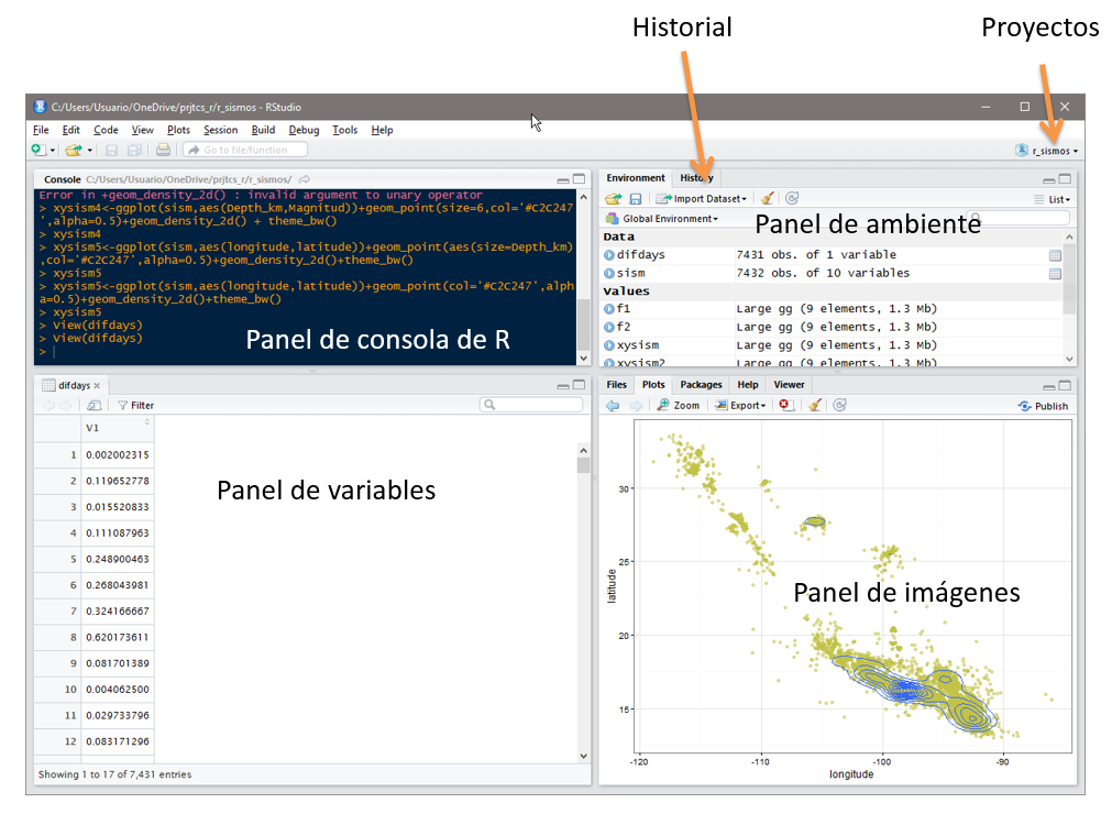
Panel de RStudio. Fuente: https://sites.google.com/site/digitcognem/firstsession
Qué es R?
Según Raidell Avello y Alexey Seissedo (2017) «R» (R Development Core Team) es un programa estadístico y un lenguaje de programación de uso libre, de distribución gratuita y código abierto, desarrollado a partir de un proyecto colaborativo voluntario de investigadores y estadísticos de diversos países y disciplinas. Es un programa basado en comandos, que permite acceder a todos los procedimientos y opciones a través de una sintaxis textual. Fue oficialmente presentado en 1997 bajo Licencia General Pública de la Fundación de Software Libre.
R es un entorno de programación para el análisis estadístico y gráfico de datos, que cada vez se hace más popular entre los investigadores de todas las disciplinas, y cada día lo suman más universidades a sus planes de estudio. Tiene muchas ventajas y es oportuno y pertinente para los investigadores cubanos de cualquier área del saber.
Como software libre es aprobado por varios motivos: transmite valores socialmente positivos (libertad individual, conocimiento compartido, solidaridad y cooperación); nos aproxima al método científico, porque permite el examen y mejora del código desarrollado por otros usuarios y la reproducibilidad de los resultados obtenidos; pueden adquirirse de manera legal y gratuita copias del programa, sin necesidad de licencias personales o académicas.
Aparte de su faceta de software libre, R tiene algunas ventajas específicas: por ejemplo, su sintaxis básica es sencilla e intuitiva, lo que se traduce en un aprendizaje rápido y cómodo; además, tiene una enorme comunidad de usuarios, estructurada alrededor de la Comprehensive R Archive Network, CRAN, que desarrolla cada día nuevos paquetes que extienden sus funcionalidades y cubren casi todas las necesidades computacionales y estadísticas de un científico.
En el año 2011 surge RStudio, ambiente de desarrollo integrado que permite una interacción rápida y amigable con R, además del desarrollo de código de forma interactiva. Paralelo al proyecto y patrocinado por la Fundación R, ha florecido la Revista R (R Journal), que desde el año 2009 divulga artículos de investigación científica en computación, estadística y otras áreas afines de interés de la comunidad. Anualmente se realizan conferencias y congresos relacionados con el desarrollo y aplicación de R en todas las áreas del conocimiento.
Como se ha comentado, miles son los contribuidores de código, extensiones y bibliotecas que amplían casi a diario el abanico de temas a tratar con este, posibilitando el crecimiento y madurez de este software, haciendo evidente además la fortaleza del software libre y el código abierto.
Cada día se suman universidades y centros de investigación científica, incluyendo las ciencias médicas, que utilizan R en su día a día, demostrando sus capacidades y fiabilidad para el análisis estadístico y tratamiento de datos frente a soluciones privativas. Sería muy beneficioso para nuestra sociedad que se comiencen a introducir estas opciones en la práctica científica de los investigadores, para seguir labrando el camino hacia una investigación científica sostenible y soberana.
REFERENCIA
Avello-Martínez R. & A. Seisdedo-Losa (2017) El procedimiento estadístico con R en la investigación científica (Cartas al Director). Medisur Vol. 15 (5). Versión online: ISSN 1727-897X.
Proyecto Primates Panamá presentó a estudiantes de maestría de la Universidad de Panamá una conferencia sobre los Objetivos del Desarrollo Sostenible (ODS 2015-2030) con el fin de familiarizar a los estudiantes con los ODS y las potencialidades que tiene esta agenda en impulsar, cambiar o mejorar las agendas nacionales de trabajo sobre biodiversidad, áreas protegidas y desarrollo en general.Desarrollo sostenible y su aplicabilidad en el modelo de desarrollo apenas se está consolidando y quizás sólo en los últimos 5 años desde 2015, el mundo comienza a darse cuenta de la ruta que representa el desarrollo sostenible, ahora, con la agenda 2015-2030, con los Objetivos del Desarrollo Sostenible (ODS).
El concepto de desarrollo sostenible puede decirse que tiene sus raíces en la Conferencia de Estocolmo de 1972 donde se reconoce por primera vez en un foro multilateral auspiciado por la ONU que los temas ambientales y sociales estaban intrínsecamente concateados y se dan los primeros pasos para el desarrollo sostenible como una buena idea global para impulsar el desarrollo.
En 1980 cinco organizaciones (IUCN, WWF, UNESCO, FAO y el PNUD, lanzan una publicación donde definieron por primera vez el concepto de «desarrollo sostenible» como principal argumento para el desarrollo humano. En 1987 es lanzado el Informe Brundtland, que es la agenda global para el cambio denominado «Nuestro Futuro Común», que es considerado el informe de mayor impacto político mundial sobre el estado mundial del medio ambiente. Este informe retoma la definición académica y la pone en el contexto político e indica que el desarrollo sostenible «es el desarrollo que es capaz de satisfacer las necesidades actuales sin comprometer los recursos y las potencialidades de las futuras generaciones.
Este informe y su impacto hizo que la primera conferencia de la Tierra en 1992, llamada la Cumbre de Río asumiera compromisos multilaterales que involucran a todos los gobiernos en la agenda del desarrollo sostenible, con las siguientes convenciones que luego de firmadas por las partes son vinculantes:
En esa cumbre también nace la Comisión de las Naciones Unidas para el Desarrollo Sostenible.Le sigue la Conferencia de las Naciones Unidas para el Desarrollo Sostenible de Johannesburgo de 2012, llamada la Cumbre de Río +20.
En el 2000 se lanza la agenda de los Objetivos del Desarrollo del Milenio hasta el 2015 y hoy contamos con la Agenda de los Objetivos del Desarrollo Sostenible, que es la Agenda 2015-2020 que ahora obliga a todos los Estados del Mundo a asumir compromisos tangibles para la solución de retos del desarrollo que sean modelos de sostenibilidad bajo todos los enfoques.
Los ODS son 17 objetivos y 160 metas y centenares de indicadores que pueden medirse para evaluar el nivel de avance de los ODS en la estructura de desarrollo de los países.La conferencia trata de determinar la importancia de las agendas internacionales en la configuración de las agendas nacionales de desarrollo a través de la implementación de políticas o las denominadas Estrategias Nacionales Ambientales (ENA) en el Ministerio de Ambiente y otras políticas sociales y económicas en el aparato de administración estatal.
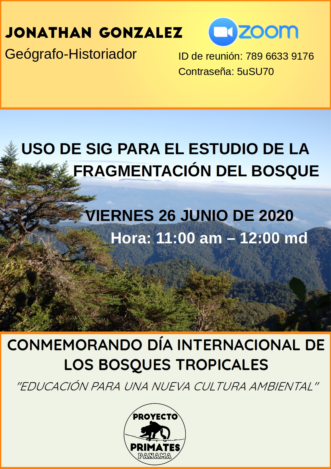
En conmemoración del Día Internacional de los Bosques Tropicales (26 de junio), Proyecto Primates Panamá organizó la conferencia sobre el uso de los sistemas de información geográfica para el estudio de la fragmentación del bosque.
El contenido de la conferencia incluyó una revisión de los programas informáticos que puede ser utlizados para realizar esta labor científica.
A continuación agregamos la presentación y dos vídeos que recogen la ejecución de esta activdad.
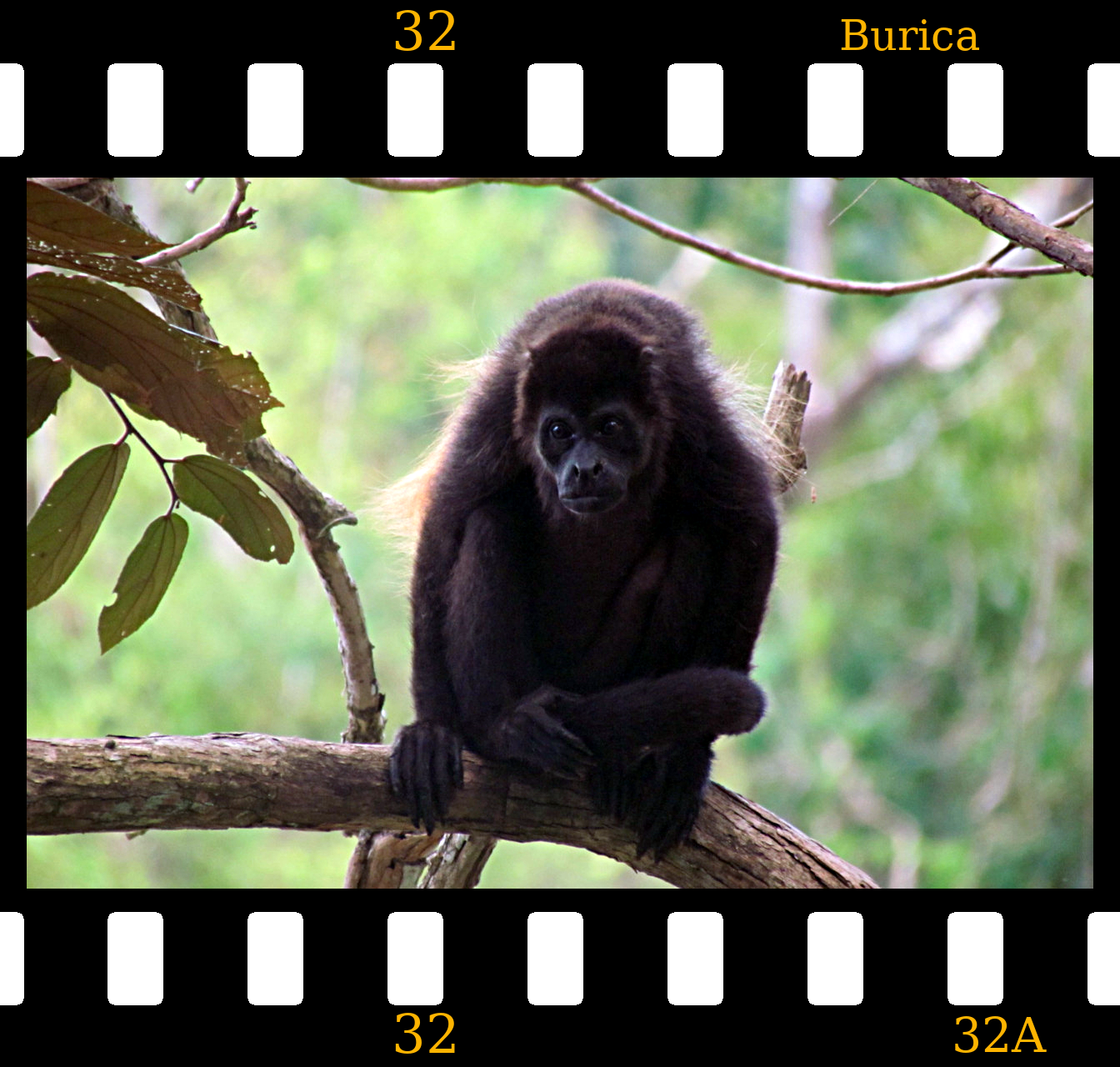
Gasira y Nala son yerré o monos araña del Este de Panamá.
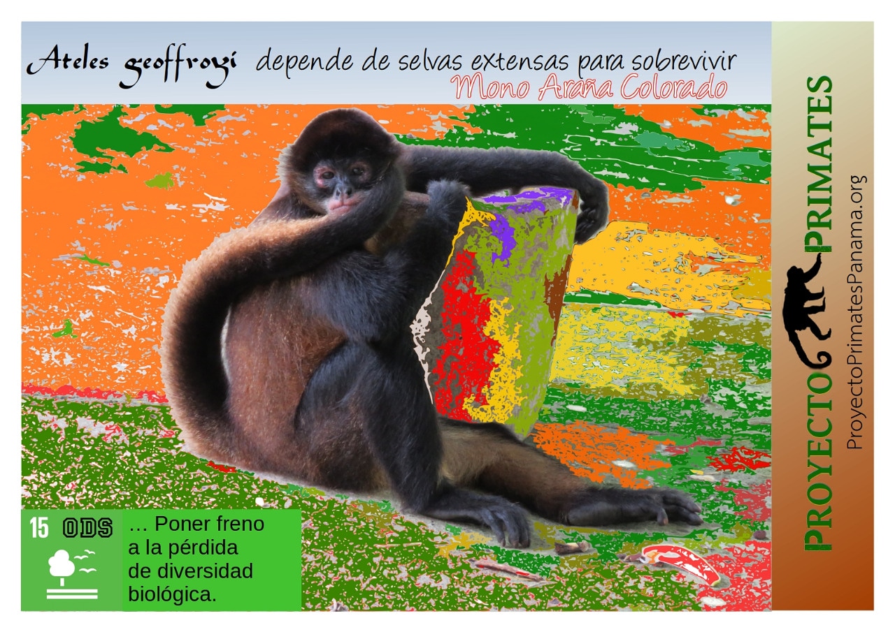
Nombre científico: Ateles fusciceps. Nombre común: Mono araña negro, mono negro, yerré. Esta especie de mono araña sólo se registra desde el Centro Este del Istmo de Panamá hasta Ecuador. Todas las especies de monos arañas requieren extensas selvas para sobrevivir con poblaciones saludables.
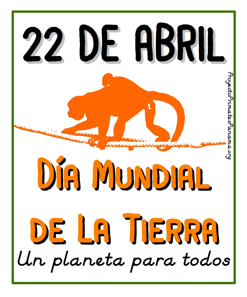
22 de Abril de 2020 es el Día Mundial de la Tierra. Hace más de un mes un silencio y un vacío de actividades humanas se tomó los pueblos y ciudades del mundo. Es la especie humana confinada en sus hogares y desalojada, incluso a la fuerza, de las calles, plazas y espacios públicos. Es la figura de los efectos de una pandemia de un síndrome respiratorio denominado COVID-19 que azota al mundo y lo tiene casi de rodillas. La gente siente temor de enfermarse o de enfermar a sus seres queridos vulnerables al virus SARS-CoV-2. Es una epidemia que ha golpeado a todo el mundo y amenaza con hacer estragos en países que ya sufren de mil calamidades y otras epidemias endémicas letales. Los números de COVID-19 todavía son irrisorios a los millones de muertos de malaria en África y Asia en los últimos 20 años. Que la ciencia y la conciencia política mundial hagan su trabajo.
22 de abril – Día Mundial de La Tierra
Los ecosistemas con todos los elementos biólógicos y abióticos son la base de la vida humana en el planeta. Recordemos que la humanidad como tal, llegó al planeta cuando el paraíso o el ecosistema estaba listo para recibirnos. El recibimiento no es gratuito. Muchos o millones de seres son parásitos y depredadores y nosotros no estamos exentos de ser víctimas de ellos. Hemos aprendido a intimidar a los macrodepredadores, pero aún no dominamos, ni conocemos a los enemigos más terribles de la humanidad: los virus y otros microorganismos infecciosos. Ellos son los verdaderos reyes del planeta. Se acaba la especie humana y ellos seguirán en la biosfera, incluso cristalizados.
No hay opción, hay que aprender a convivir con todos los seres vivos del planeta. Hay que respetar sus espacios, sus ambientes y mantener la distancia de aquellos que no han evolucionado a vivir cercano a nosotros. La humanidad se ha enseñoreado sobre casi todo lo existente en el planeta, le ha perdido el respeto a la naturaleza, pero en muchas ocasiones, ella es capaz de devolverle la afrenta.
Durante el último mes de cuarenta total en el mundo, muchas especies de la vida silvestre han regresado a los lugares donde las actividades humanas los habían desplazado desde hace décadas o cientos de años. Así vemos en las calles de ciudades vacías, desde cabras de montaña en Gales, zarigüeyas en Colombia, alces en Canadá, venados en Japón, hormigueros en Brazil, linces en España, jabalíes en Alemania, gamos en Inglaterra, etc. Este momento fugaz es un telón de enseñanza moral y ambiental que nos debe llevar a la pregunta: ¿Qué hemos hecho en el planeta? ¿Somos los dueños absolutos del mundo? ¿Quién reparará nuestros daños ambientales? ¿Es justo y bueno destruir por vanidad humana, la naturaleza? ¿Vale la pena convertir todo un ecosistema en un gran potrero o en un inmenso cultivo de arroz? ¿Por qué no pensamos que el planeta es para todos y que todos los seres necesitan conservar espacios vitales para su supervivencia?
La vida silvestre que conocemos en el planeta lucha por su supervivencia de manera instintiva e incluso razonada como ocurre con algunos primates. Al igual que los humanos, ellos deben defenderse de los enemigos naturales. Además, ellos están expuestos a mil patógenos, algunos letales que diezman sus poblaciones e incluso las pueden extinguir. Por ejemplo, los murciélagos como especies han logrado sobrevivir durante millones de años al ataque de innumerables especies de virus, bacterias u hongos. La naturaleza dura es implacable y también es implacable cuando el hombre abusando de su condición de especie dominante invade los espacios silvestres, más allá de lo debido o de la ética.
Sirva este día para recordarnos a todos, que la Tierra es un lugar para todas las especies existentes, es un planeta para todos, y es nuestro deber como especie humana, coadyuvar en educar a las nuevas generaciones, a respetarla, protegerla y nunca ser abusadores de ella, ya que las consecuencias de los abusos terminan siendo asoladoras. El humano tiene espacios de acción suficientes para desarrollarse plenamente y el día que aprendamos a ponernos límites como especie, con conocimiento, leyes, ética y valores, ese día estaremos construyendo una humanidad con futuro bueno y armonía natural.
Todos a favor de la madre Tierra y nunca contra ella.
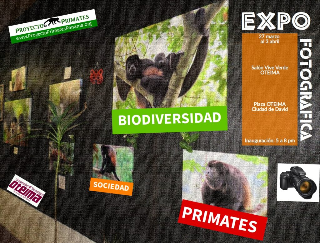
Afiche de Expo Fotográfica 2020 de Proyecto Primates Panamá ——————–
Este año 2020 la Expo Fotográfica de Proyecto Primates Panamá tiene de patrocinador principal a la Universidad Tecnológica OTEIMA, a realizarse del 27 de marzo al 3 de abril de 2020 en las instalaciones principales de OTEIMA en la ciudad de David.
La inauguración del evento será el día 27 de marzo a las 5:00 de la tarde en la cual habrá una conferencia magistral corta sobre el tema de la exposición: Biodiversidad, Primates y Sociedad, que será dictada por el Dr. Ariel Rodríguez Vargas.
Esta actividad será abierta a todo público y con acceso libre. Las obras pueden ser adquiridas y los fondos serán donados a Proyecto Primates Panamá.